Home
Up
Today a cold front was blasting in and was supposed to make for a tornado-less squall line. Mid level winds were blah. Not much hope.
![]()
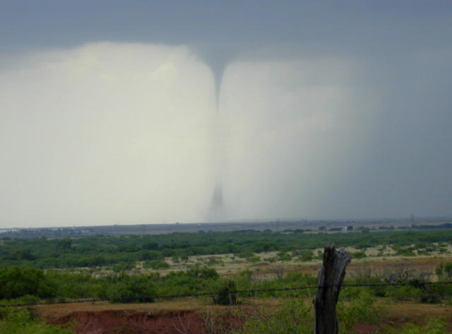
But!.... we went after the first storm about 20 miles SW of Wichita
Falls, and first saw this very near Archer City, TX:
(Click on picture for larger size image)

![]()
As it roped out we saw this one (and you may have seen it on The Weather
Channel from Matt Crowther's video)...

A really pretty land-spount looking tornado (but note the clear slot, meso, etc). Since
this really was a supercell, we should perhaps call the twister a super-spout:-)!
![]()
A while later near Jacksboro we saw a large tornado going towards the ground from what was thought to be a gusted out squall line (no digital photos, but VHS hopefully will be okay). This was seen by other teams from various perspectives.
![]()
Some time after that, we stopped in Denton, TX as a storm in a line forward of the squall line rapidly formed and then attempted to drown us as it tried to blow us away. We punched through the rain (while hearing a tornado report nearby - but we were okay in outflow winds). Then we caught up with the inflow and drove along the outflow/inflow boundary. The outflow was measured at over 50mph right down the highway, while the inflow appeared to be over 20 mph whenever we got ahead of the outflow boundary At one point, driving right with the boundary, we saw a very nice conical spinup just off the road to the left - at most 1/4 mile. It had very fast rotation but just didn't last. It didn't seem to quite reach the ground, and since we were busy driving, twiddling radios, computers, etc. we didn't have a camera ready, so again, no pictures.