The drive south was very frustrating. Slow road. Narrow road. Slow locals. Wide Locals. Good digital cell phone. No analog cell phone (required for data).
It took a long time to get to Shreveport - we arrived around 1600 local. Surprisingly, the front had slowed down and was just south of Shreveport, with a severe thunderstorm in Shreveport on our arrival. We went south of it, intercepted it, and ...
Well... no rotation, no structure, just heavy rain and some pretty lightning.
Severe warnings continued and after some dawdling, we chased some more. We just wanted to photograph some lightning. But even there, no luck. We ended up spending the night in a nice Super-8 in Monroe, LA.
As far as chasing conditions... slow narrow roads, slow locals, tree tunnels, very few places with visibility.
As posted on the web, chasing Louisiana sucks!
And now... well, the Sequoia gets its first oil change, and then we will wander west playing tourist along the TX coast, hoping that there will be some sneak moisture along the Rio Grande that will set up chasing in upslope country of W TX, E NM, E CO later in the week.
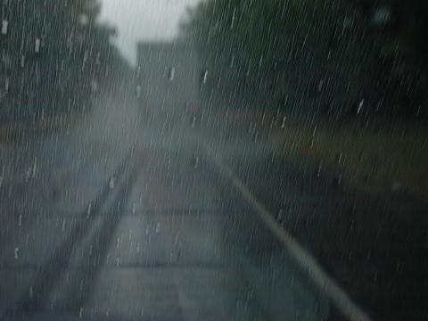
The following picture pretty well summarizes our chase:
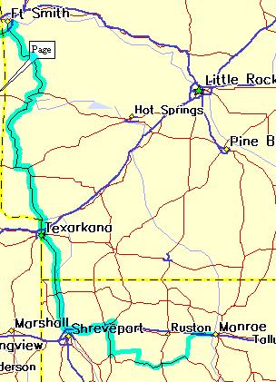
This map shows our route from Ft. Smith, AR to Monroe, LA.